
Environmental benefits
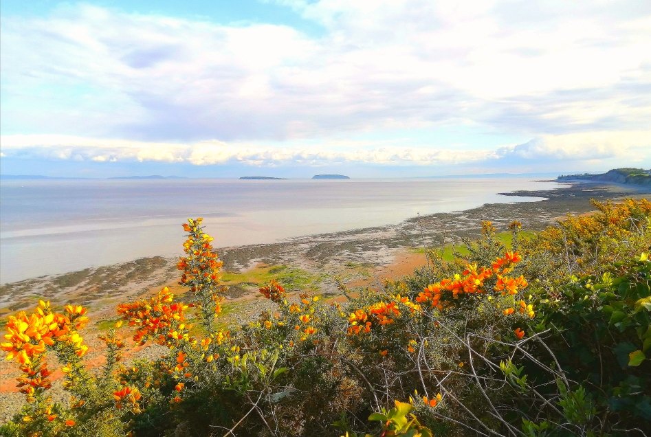
Photo by Lesley Lawrence
Environmental Designations
The Estuary has International Environmental Designations which may be summarised as follows:
Ramsar sites to stem the loss of wetlands now and in the future.
Special Area of Conservation (SAC) for its “estuaries” feature which supports rare, endangered or threatened species of plant or animal (other than birds) and important habitats.
Special Protection Area (SPA) to seek to ensure the survival or viability of rare and vulnerable bird populations and for regularly occurring migratory species.
The intertidal SAC and SPA together form a European Marine Site (EMS) which sets out how these features should be managed.

The centreline of the proposed Great Western Power Barrage has been positioned downstream of the greater part of the designated areas. This fits well with its dual use for generating power as well as providing flood protection for all areas upstream.
Any potential barrage proposals that are further downstream of this location will also bring similar benefits to these areas, and the analysis presented on this page would equally apply to such proposals.
Environmental approach
There will be changes. The challenge is to embrace the opportunities to redress the degradation to the Estuary. For a while, Bristol was one of the main centres of trade with the rest of the world. Cardiff and Newport then expanded rapidly for the export of coal and other activities associated with the Industrial Revolution. There is still more that needs to be done to complete the restoration of the environment.
As an example, the water velocities upstream of the barrage are likely to be lower and may not reach the same spring tide heights. This will give an opportunity for the salt marshes along lengths of the estuary to be re-established to create additional foraging for migratory birds. Some of these salt marshes could include small islands separated from the mainland for other waterfowl to breed undisturbed by predatory animals.

In addition, the food chain in the estuary will be enhanced. The water upstream of the barrage will have lower silt content allowing greater light penetration in the water column. This will encourage more green growth, including plankton, adding to the food chain for higher forms of life eventually including birds and fish.
Most of the estuary upstream of the line of the barrage is designated as a ‘heavily modified’ water body under the Water Framework Directive having ‘being altered by extensive human activities’. A sizeable part of these modifications will have been to stop the channel from meandering and encroaching on human developments as well as preventing flooding. The aim will be to use changes to the flow patterns to ‘restore’ as much of the banks of the estuary as possible to provide noticeable improvements to the greenery and the amount of bird activity.
Flood prevention
Flood levels
Flooding of lower-lying areas around the Severn Estuary has and continues to occur around high spring tides. This is typically when these tides are accompanied by heavy antecedent rainfall in the upstream catchment and by strong south-westerly winds.
This will be exacerbated by general sea-level rises which, according to the Met Office, could be up to 1.0m by 2100. However, their current research indicates that UK sea levels will continue to rise well beyond 2100 under all future greenhouse gas emissions scenarios, although the severity of these rises strongly depends on which one of the assumptions is realised. Under a low emissions scenario, the approximate projected ranges at 2300 for Cardiff are 0.5-2.2m which, under a high emissions scenario, increases to 1.4-4.3m.
The research also found that at some locations the 1 in 10,000-year flood event of today could be expected more than once per year by 2300.

Time series of the time-mean relative sea level change for Cardiff based on the nearest Class A tide gauge location (Newport)
Notes: Solid lines indicate the central estimate and dashed lines indicate the 5th to 95th percentile range for high (red), medium (light blue) and low (dark blue) emissions scenarios. All projections are presented relative to a baseline period of 1981 to 2000. Source: UKCP18 Marine Report (Palmer et al. 2018b, Figure 3.1.4)
Cardiff is considered to be one of the places most likely to flood in the UK. Other major population centres around the Estuary including Bristol and Newport are also liable to flooding. There is also a history of flooding around the Somerset levels as occurred in the winter of 2014 which repeated the experiences of earlier generations as outlined in the display at Muchelney Abbey in Langport, Somerset.
The combination of circumstances leading to flooding can be predicted from modelling the tides and weather forecasting.

Projected annual flood risk areas by 2100 [Source: Climate Central]
Areas on the map that are shaded red are projected to be below the annual flood level by 2030. The "annual flood level" is used to denote the water level that local coastal floods exceed on average once per year. In other words, ten floods are statistically expected to exceed this level over ten years, although some years might have two or more incidents, and other years none.
How a barrage mitigates flooding
When there is a perceived risk of flooding, the gates along the barrage will be operated either to prevent or at least to minimise the effects of rising tides on flooding upstream.
Closing the barrage gates at low tide will hold back the tides. Thus, the barrage would prevent all incoming tides from entering the upper estuary.
The elevation of the top of the barrage will be designed to ensure that this is the case for all reasonable scenarios over its design life which will be at least 120 years.
Some may question whether this would include the catastrophic flooding in 1607 where the water level is recorded by a mark at St Bride’s Church in Wentlooge (north east of Cardiff). The estimated flood level was 7.14m AOD amounting to a water depth of around 1.5m. Even though this event is comparatively recent, the definitive cause is not known. Whilst such a freak tidal surge may not be a design criterion, if it were to occur again, the barrage may be overtopped. The critical period would be 1-2 hours either side of the high tide when the overtopping surge waters would most likely just to fill the basin upstream and not lead to any significant flooding.
The barrage can also be used to mitigate flooding of farmland up the estuary to the tidal limit at Gloucester. The same principle would apply: either prevent rising tides coming upstream of the barrage or reduce them appropriately.
A management tool will be developed for flood mitigation as the design of the barrage progresses.
Coastal erosion
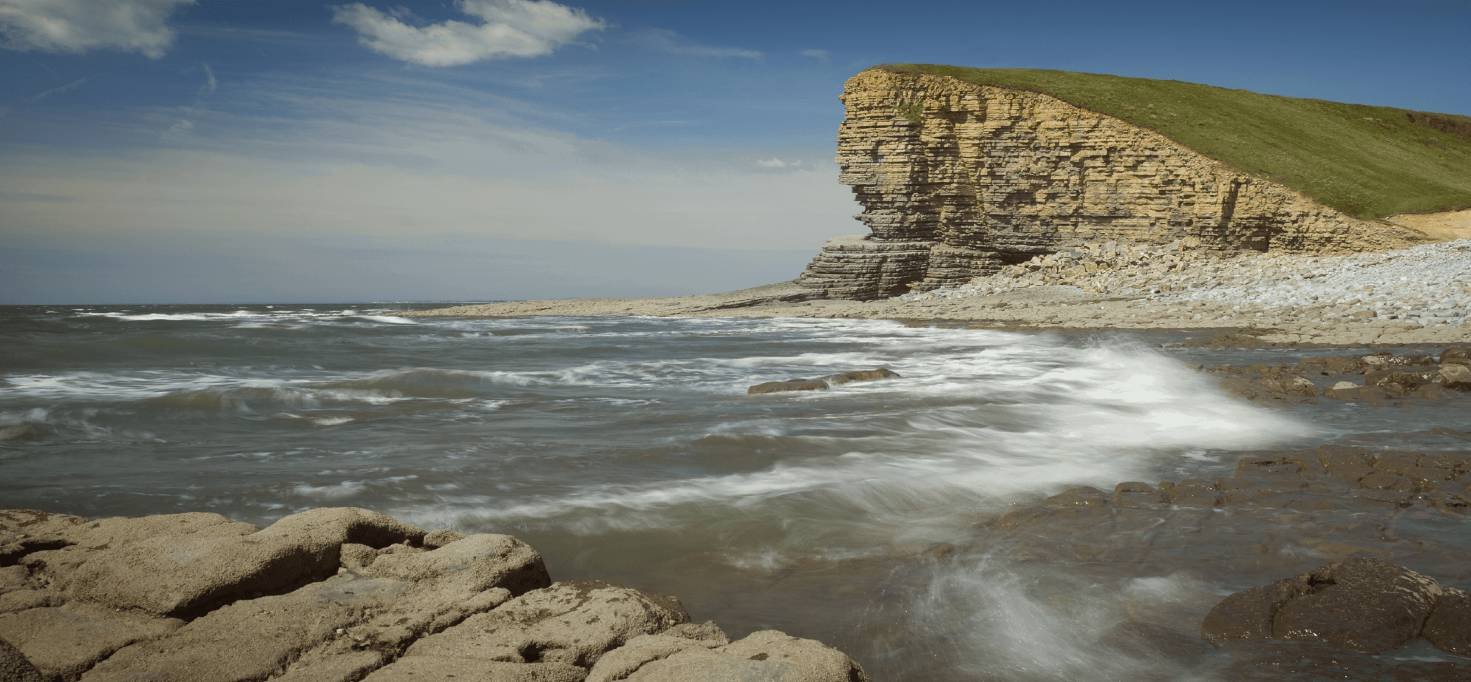
There will be a slowing of the water together with a reduction in the height of waves upstream of the barrage. The height of the waves will also reduce since the distance over which the wind blows, will be shorter. This will serve to reduce the rate of erosion on the cliffs on either side of the estuary. Whilst none of this erosion in this area is as dramatic as along the east coast of England, there are nevertheless near-annual incidents of rockfalls along the Jurassic coast extending up to and including around Penarth.
The photo below illustrates this phenomenon: the main erosion has occurred where waves have pounded on the rock face.
Impact on fish in the estuary
Studies have been carried out on the features that minimise fish mortality when passing through turbines.
The blade impact mortality rate has been determined to be a function of the blade speed and spacing as much as the length and speed of the passing fish.
The main studies that are cited are from Oak Ridge National Laboratory Research, as published by Idaho National Laboratory. These indicate that there is negligible fish mortality if the tip speed of the blades is below 12.2m/s (40ft/s). It is accepted that this information will need to be reviewed for the diversity of fish in the Severn Estuary and whether any of the concerns over indirect as well as direct mortality are justified.
The aim is for this criterion will be satisfied in the design of the turbines for the Great Western Power Barrage.
However, it is recognised that there may still be some disorientation of fish passing through the turbines and becoming subject to predation on exiting the turbines. Accordingly, consideration will be given to the possibility of siting turbines away from the preferential fish pathways in the Severn Estuary and maybe reducing generation at times when fish movements are peaking.
All these issues will need a Technical Forum to pool the experience of fish experts.
We are confident that we will be able to secure the safe passage of the great majority of fish through the proposed barrage.
Carbon footprint
The carbon footprint of the barrage has been assessed based on outline quantities compiled for the original from Lavernock to Brean Down. Allowing for up to 70% of the cement to be replaced with GGBS (ground granulated blast-furnace slag), a lower carbon by-product of the steel making industry, the payback period for the barrage is around 12-15 months.
The proposed Great Western Power Barrage from Lavernock to the Stert Flats (near Hinkley) will generate at least 20% more electricity. Even so, when its design has progressed further, the anticipated payback period will still be less than 2 years.
These payback periods compare with a design life of 120 years although there is no reason why its actual life should not continue indefinitely.
Payments for ecosystems services
Consideration will be given to using the ‘payments for ecosystems services’ approach for at least a first stage economic assessment of the potential benefits and costs to be derived from the proposed barrage.